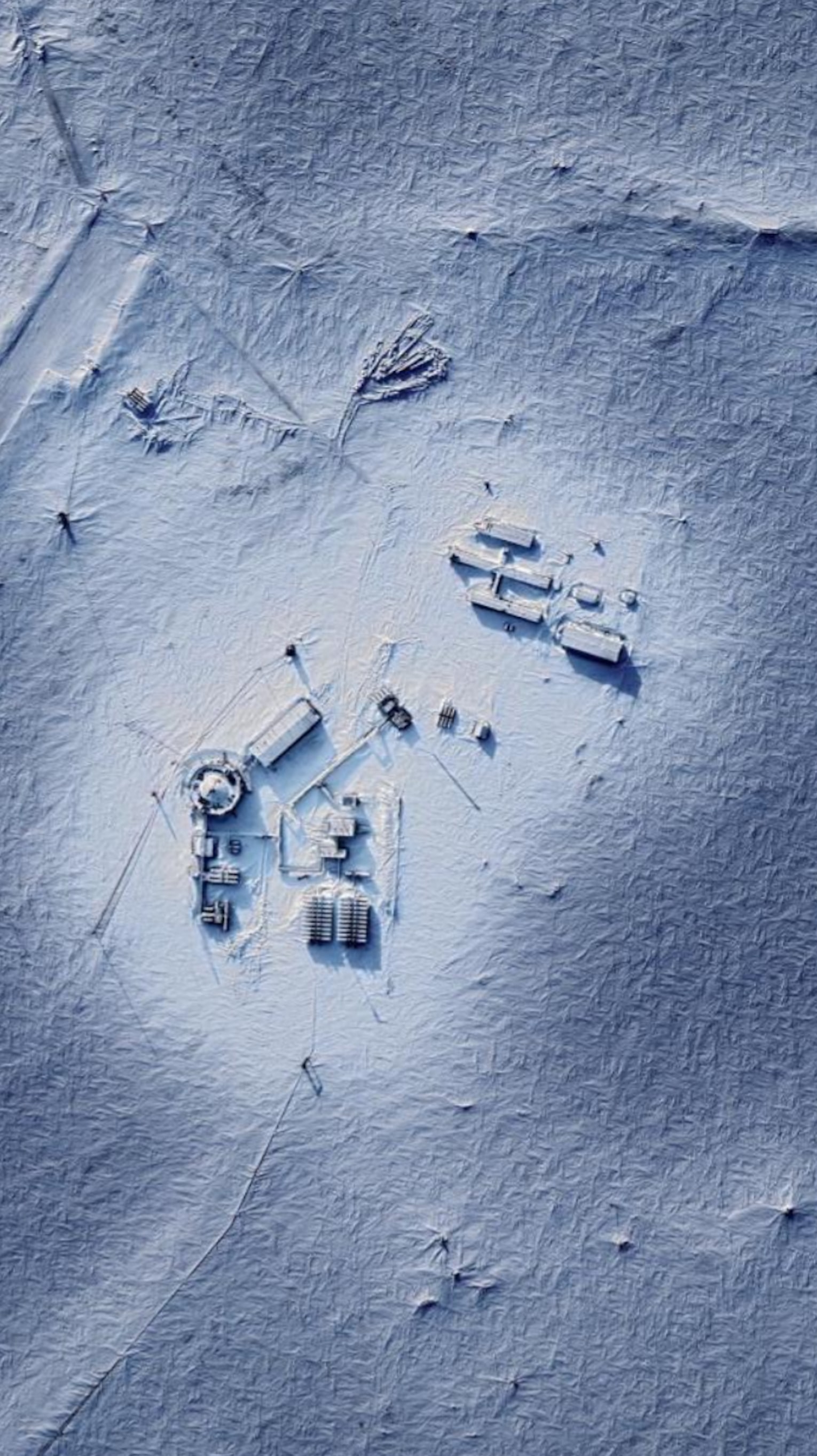
Home ATLAS DragonSat Qube SerenSat AI Phoenix QuantumSat Geospatial Ground Station Technology Our Team Contact
Geospatial Intelligence

Military Geospatial
Intelligence

Precision geospatial intelligence through satellite imaging and advanced data analysis — supporting allied defence with accurate mapping, change detection, and actionable insight.

Scroll
Accuracy First

Every data point we deliver is drawn from rigorously verified sources — high-resolution satellite imagery and multi-spectral datasets. By combining technological rigour with analytical expertise, Infinity Space delivers intelligence that reduces uncertainty, minimises risk, and supports mission success across today's rapidly evolving defence landscape.

Multi-spectral
Change Detection

Seeing what the eye cannot

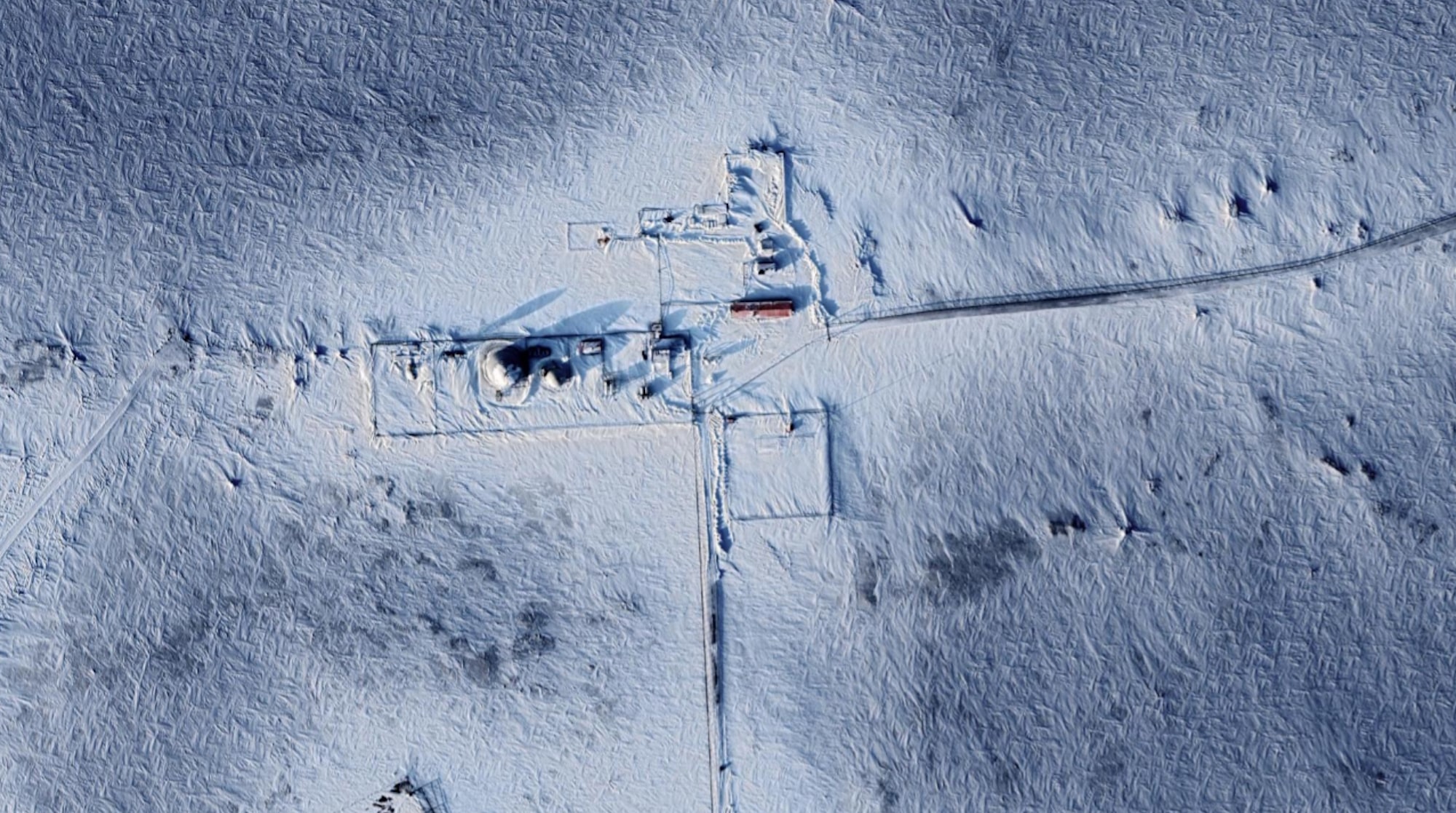
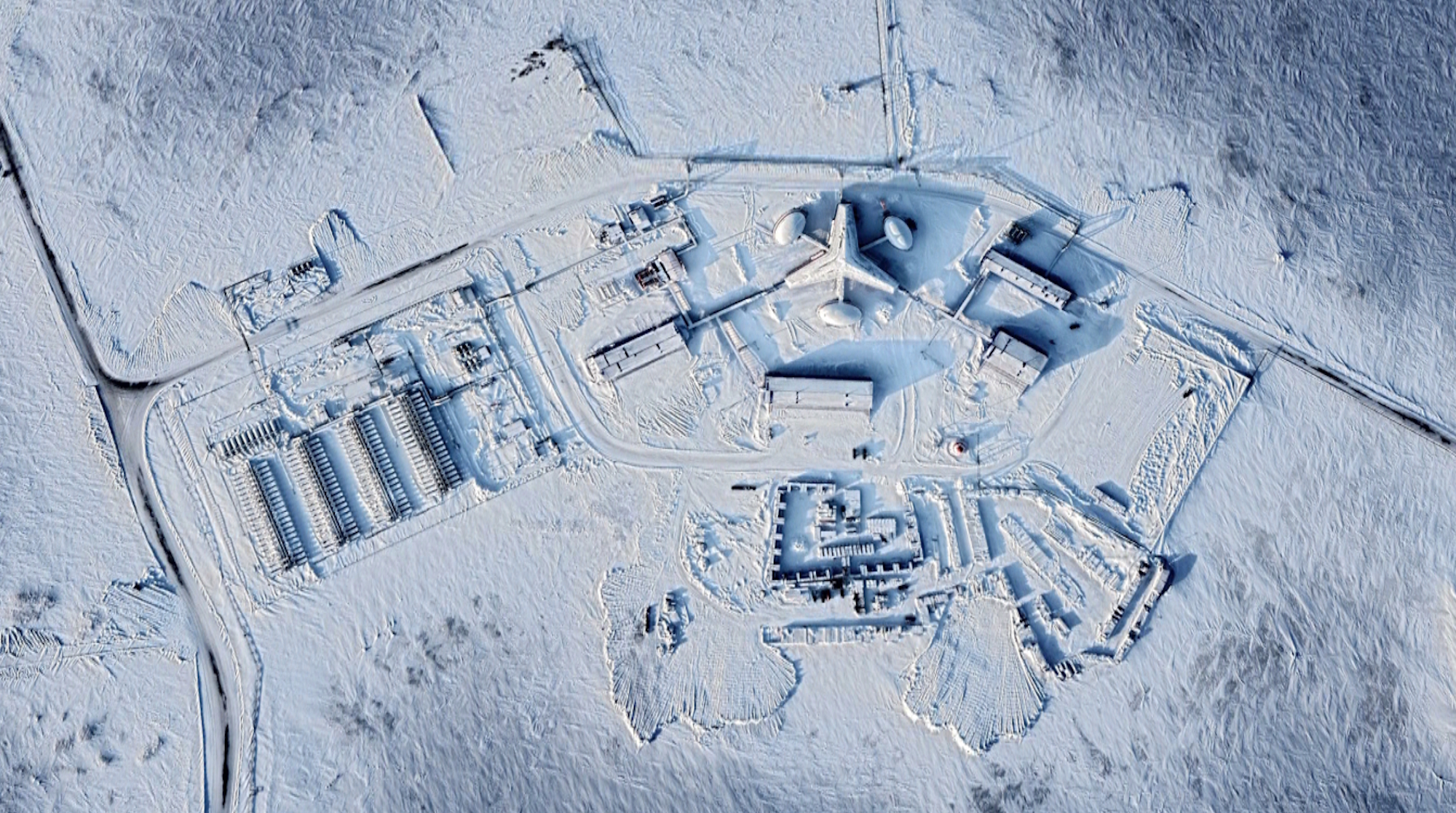
Multi-spectral imaging uncovers insights invisible to the human eye — detecting subtle variations in materials, vegetation, and structures.

This enables precise identification of camouflage, concealed installations, and environmental factors. Temporal change detection adds a critical dimension: by comparing imagery across dates, analysts track new construction, infrastructure expansion, and asset movement with exceptional accuracy.
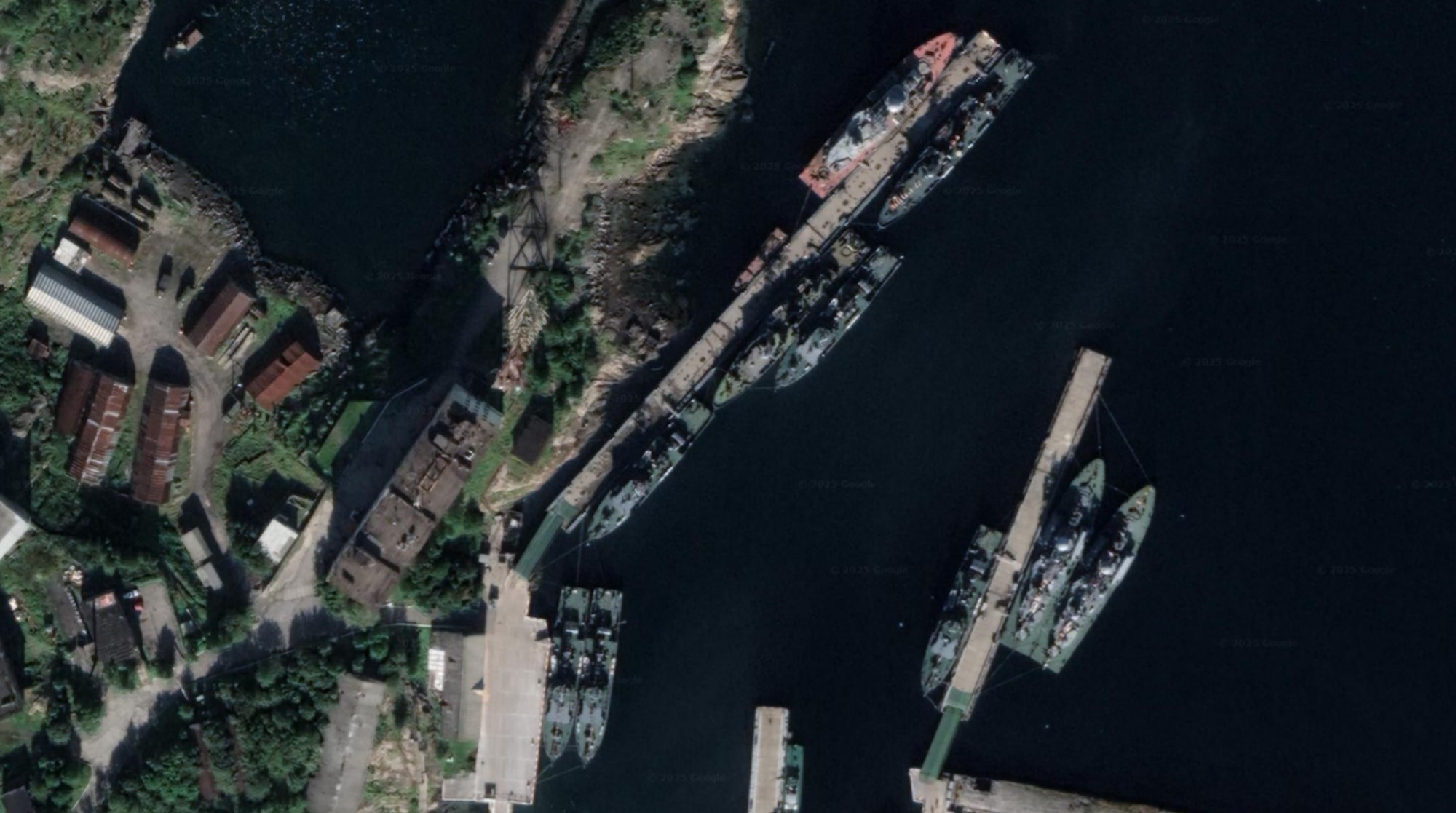
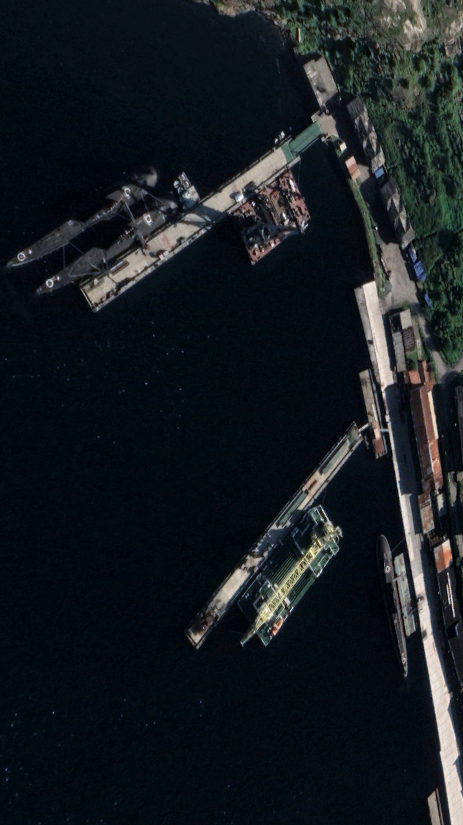
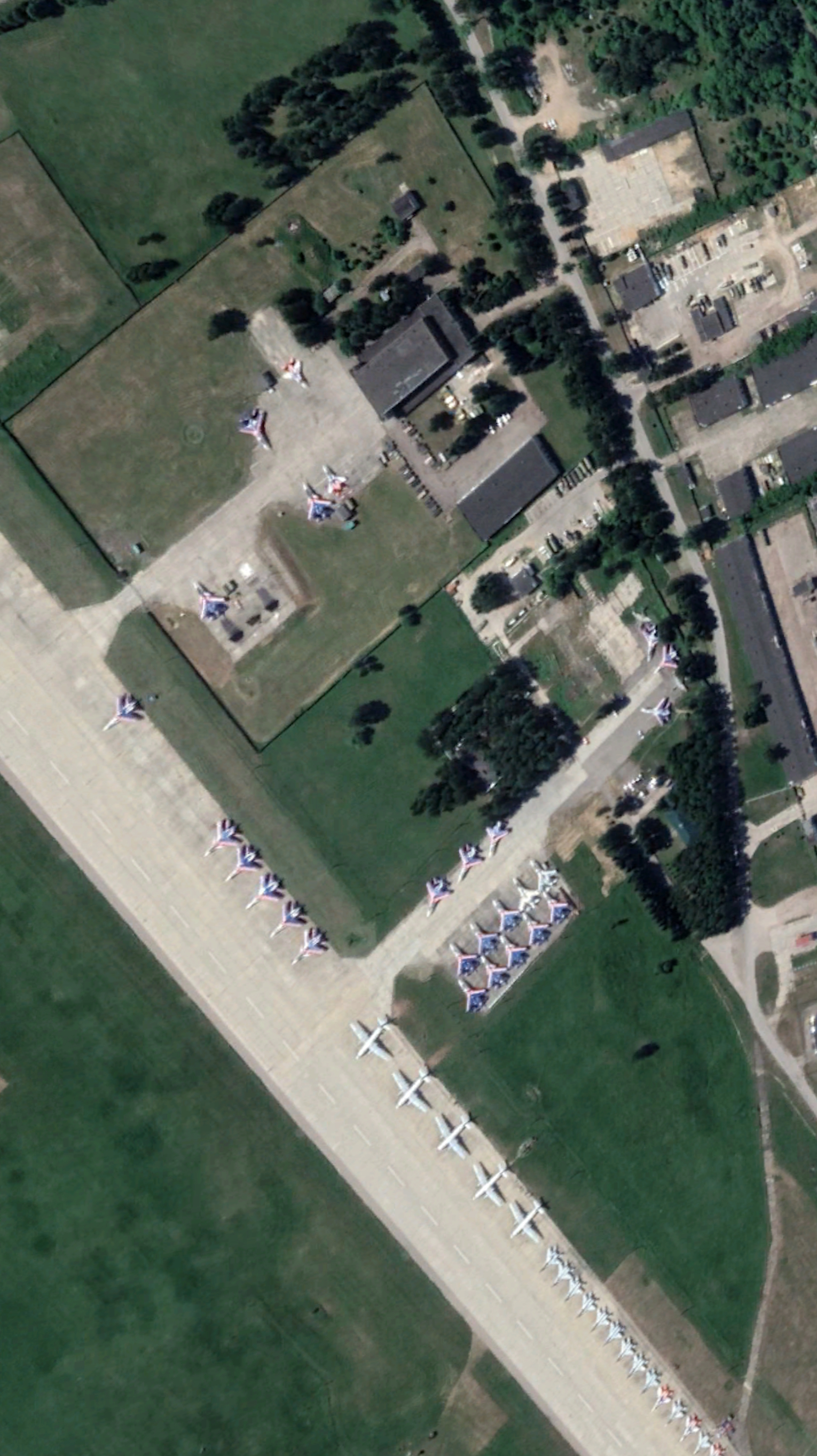
Situational
Awareness

The bigger picture, with clarity

By integrating satellite imagery, terrain models, and geospatial analytics, we deliver real-time insight so commanders can assess threats, anticipate challenges, and make informed decisions.

Beyond presenting imagery, we interpret and contextualise it — highlighting patterns, anomalies, and emerging risks so operations are proactively guided by reliable, evidence-based understanding of the battlespace.

Tailored
Mission-Ready

Intelligence built around the mission

We design every intelligence product around specific client requirements, aligned directly with mission objectives.

For NATO and allied partners, that means geospatial insight adapted to multinational operations — fitting seamlessly into established command structures and workflows, strengthening interoperability across allied forces with a shared, accurate understanding of the operational environment.

Capabilities

Precision intelligence, end to end

From satellite tasking to actionable insight, Infinity Space supports allied defence and security missions worldwide.

Reconnaissance

Satellite Imaging

Optical, radar, and multi-spectral data deliver high-resolution, real-time views of strategic locations worldwide.

Mapping

Strategic Infrastructure

Detailed mapping of bases, airfields, transport corridors, and supply networks reveals layouts, vulnerabilities, and change over time.

Fusion

Terrain & Analysis

Satellite imagery, elevation data, and expert interpretation produce realistic models of operational landscapes.

Trusted Collaboration

Proudly working with

Partners of Infinity Space